4.6 Reading charts
Nautical charts use a bewildering array of symbols to convey information. The full list is found in a book ‘Symbols and Abbreviations Used on Admiralty Paper Charts’, also known as ‘Chart 5011’. However, sea kayakers only need to know a small proportion of these symbols.
Land on charts, above springs high water, is colored yellow. Deep sea appears as white, with blue used for shallow areas. Green is used to indicate parts of the seabed that can dry out at low tide, but which are covered at high water on a spring tide.
The numbers that cover a chart are depths. Underlined numbers are drying heights – i.e. how high that place will be above the water at a low tide. Both depths and drying heights are measured with respect to the ‘chart datum’ - generally the level of the lowest possible (astronomical) tide. The chart datum is the same as the zero used for tide tables.
Wiggly lines on charts, looking like waves, are used to indicate areas of rough water. Arrows are used to indicate tidal stream directions. Buoys are illustrated on charts using symbols that look like the shape of the buoy.
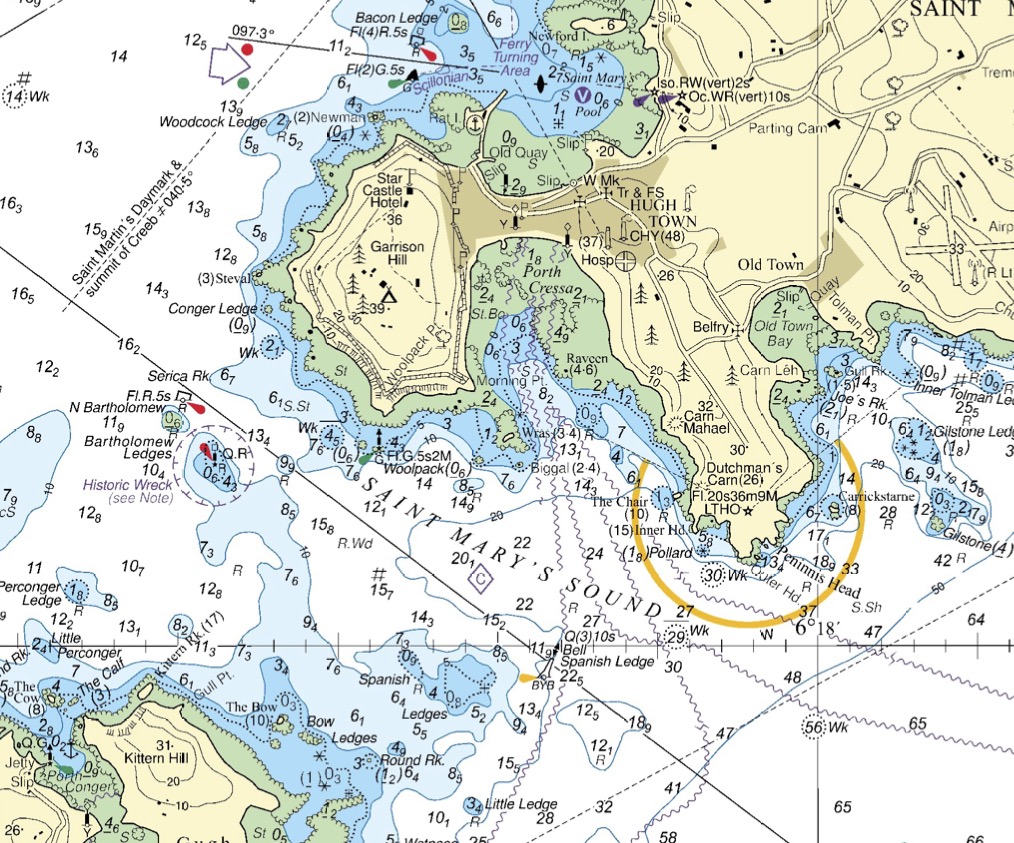
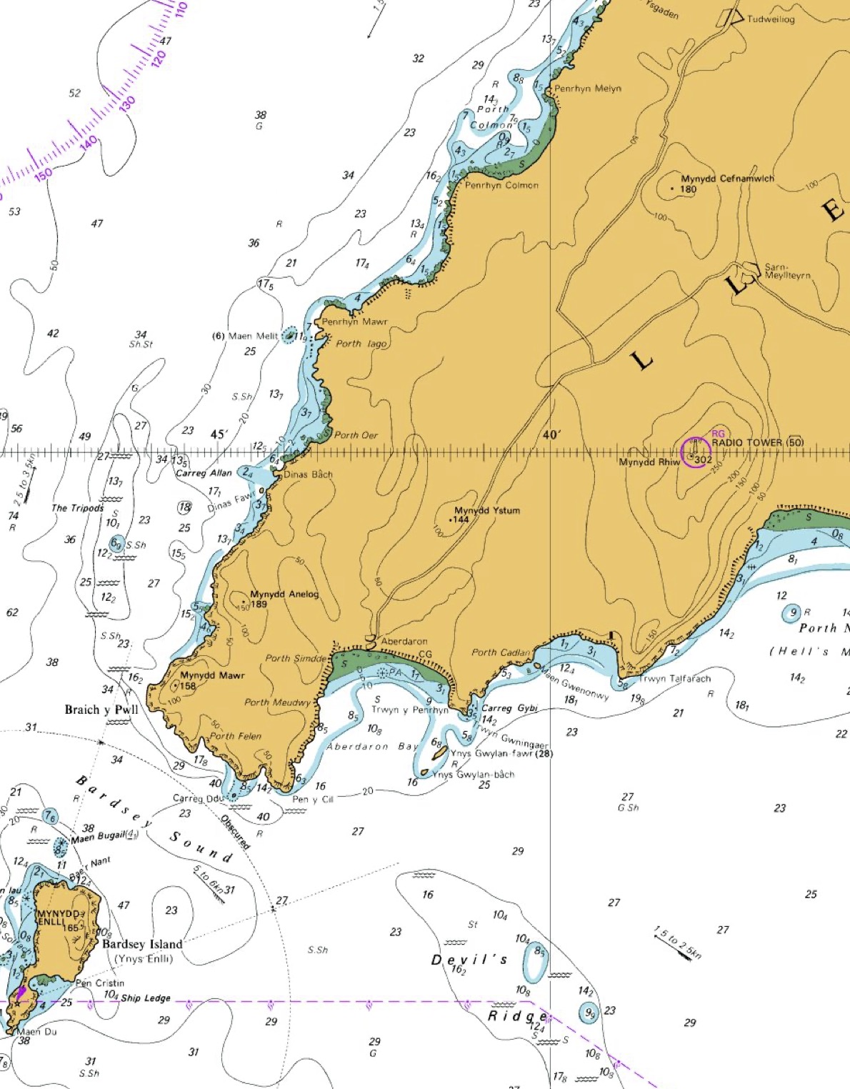
Charts © Crown Copyright and/or database rights. NOT FOR NAVIGATION. Reproduced by permission of the Controller of Her Majesty’s Stationery Office and the UK Hydrographic Office (www.GOV.uk/UKHO)