1.6 Environmental clues
1.6.1 Wind direction
It’s fairly straightforward to determine wind direction if you’re standing in the wind, but we often find ourselves starting the day in a sheltered location, or a place where the effects of the land may affect the local wind. Some indications of wind out on the water might be:
Flags flapping in the wind
Boats swinging on their moorings to face into wind - although the effects of tide sometimes need to be considered
Birds tend to take off into the wind
1.6.2 Clouds
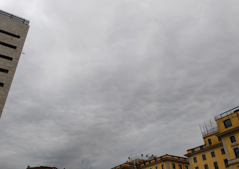
People with local experience and some knowledge of meteorology can tell a lot from looking at the clouds in the sky. For those of us with less experience, there are still some clues to be gained from the clouds - it’s fairly obvious that blue cloudless skies imply fine weather and dark brooding clouds are a portent of imminent rain. Perhaps most useful is the ability to compare the clouds in the sky to the weather forecast - if the clouds arrive earlier than forecast, this implies that the other forecast changes (e.g. wind, rain), may also occur early. Beyond this, some knowledge of meteorology, like the structure of depressions and the ability to understand synoptic charts, is helpful in understanding clouds.
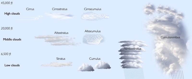
We can classify clouds by:
How high they are - low clouds form below ~6,500 feet, middle clouds from 6,500-23,000 feet and high clouds from 16,000 to 43,000 feet.
Their shape - do they form layers (layer clouds are called ‘stratus’) or clumps (clumpy clouds are called ‘cumulus’)
Do they bring rain? Rain clouds are generally quite tall (often extending between the low/middle layers described above), and have dark/grey undersides due to blocking the sun’s rays. These clouds have nimbo/nimbus in their name - e.g. ‘nimbostratus’ (a rain bearing layer cloud), ‘cumulonimbus’ (a tall puffy thunder cloud).
1.6.2.1 High clouds - Cirrus
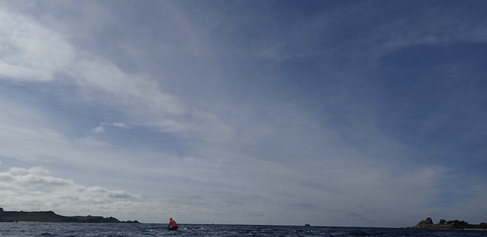
The highest clouds in the sky. forming at 16,000 to 43,000 ft are known as ‘cirrus’. These clouds are made from ice crystals and appear white and wispy
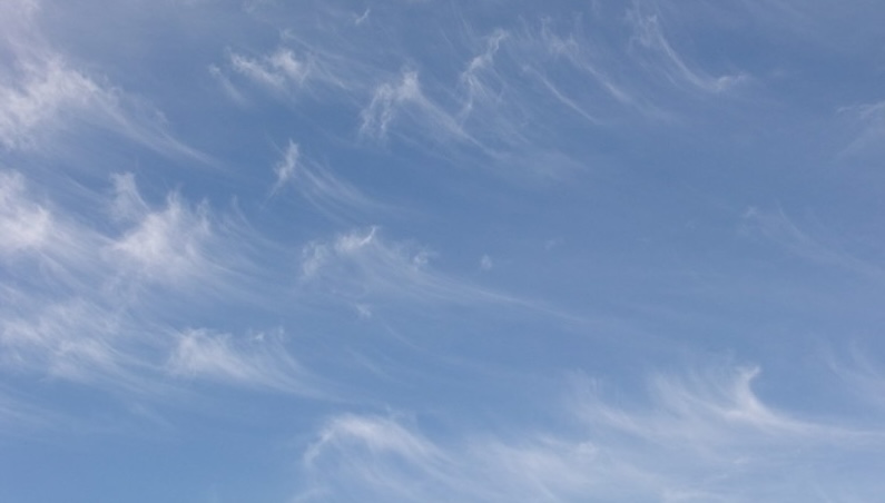
Cirrus indicates moisture in the upper levels of the atmosphere. Cirrus can be the first sign of the arrival of an Atlantic depression - indicating that rain and winds are likely in 10-15 hours. The more dramatic the cirrus clouds the more likely it is that stormy weather is on the way.
The lines of cirrus clouds indicate the direction of the high level wind, and thus the direction in which the approaching weather is coming from. The high level wind will normally be coming from a westerly direction. If you can see these clouds move fairly easily, that’s a sign of a strong jetstream and likely high winds to come.
The high level wind wind may well not be in the same direction as the wind at the surface. The difference between the two can tell you whether change in the weather is likely via the crossed winds rules:
With your back to the surface wind, if the upper winds (or cloud movement) comes from the left, then the weather is likely to get worse
With your back to the surface wind, if the upper winds (or cloud movement) comes from the right, then the weather is likely to improve
If surface and high winds align, the weather may not change
These rules come from consideration of the conditions in a low pressure system - the surface winds will blow close the the isobars, whereas the high-level jet-stream winds will blow west to east over the top of the system.
Wispy cirrus clouds may be followed by a high-level cloud that forms as a layer, rather than as individual streaks. This is cirrostratus - a milky veil of ice crystals. This cloud won’t block the sun or moon, but may produce a ring halo around it.
Cirrus followed by cirrostratus is a clear sign that the poor weather associated with a low pressure system is on its way - expect stronger winds in 3-8 hours and rain in 6-12 hours.
Cirrocumulus - small, puffy high clouds - is a very rare cloud type - altocumulus can look similar and is rather more common. It’s not especially useful for predicting weather in any case.
1.6.2.2 Middle clouds - Alto
The middle layer of clouds, forming at 6,500 to 23,000 feet, are given the prefix ‘alto’. Like cirrostratus, altostratus is a layer cloud. As well as being lower, altostratus is thicker. It may be possible to see the sun through altostratus, but it will appear ‘watery’, or as if seen through thick layers of ground glass.
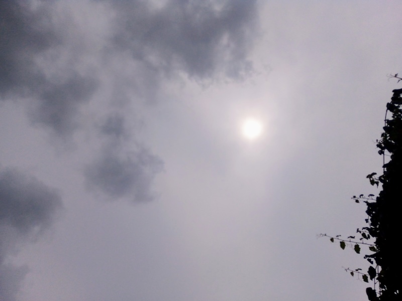
Altostratus, especially if it gets thicker and lower, is a sign of imminent rain. It is not the altostratus itself that brings the heavy rain, but the nimbostratus that often comes behind it. Ragged lumps of grey cloud below the altostratus layer, called pannus, form from moisture in the air due to rain that is falling but not yet reaching the ground. If you see these clouds, rain is imminent.
Altocumulus clouds are at a similar level, but broken into smaller cloud fragments.

Altocumulus is a somewhat ambivalent cloud. It indicates a degree of instability due to rising warm air, which may develop into rain from a front or local showers. However, it could equally likely remain fair. Perhaps the best advice is to keep an eye on the sky to see if the altocumulus consolidates into altostratus, or if thick cumulus starts to build below it.
1.6.2.3 Low layer clouds - Stratus
Low clouds form below 6,500 feet. We’ll focus first on the low layer clouds - stratus and its variants. These lower clouds will block out the sun. Stratus is a flat sheet of grey cloud.

Stratus can be associated a warm tropical air mass. It may bring drizzle if especially thick, but not heavy rain.
Stratocumulus refers to a range of clouds that are similar to stratus but more clumpy.
Much of our clouds are stratocumulus of some variety. In winter, high pressure systems can be associated with dense stratocumulus.
Dense, thick and dark stratus clouds can bring rain. Such clouds are called ‘nimbostratus’.
Nimbostratus may appear similar to low, dense stratus, or lowering altostratus… but the differences are somewhat academic - when the rain starts to fall, you can safely state that you have nimbostratus above you.
1.6.2.4 (Low) Cumulus clouds
Even in the fair weather caused by high pressure systems, there may be some clouds in the sky. As the sun shines and heats the surface of the earth, the air above the warm surfaces warms and starts rising. This warm rising air often contains moisture which condenses and forms clouds as it rises. The resulting puffy cotton-wool like clouds that form in the blue sky are known as ‘fair weather cumulus clouds’.
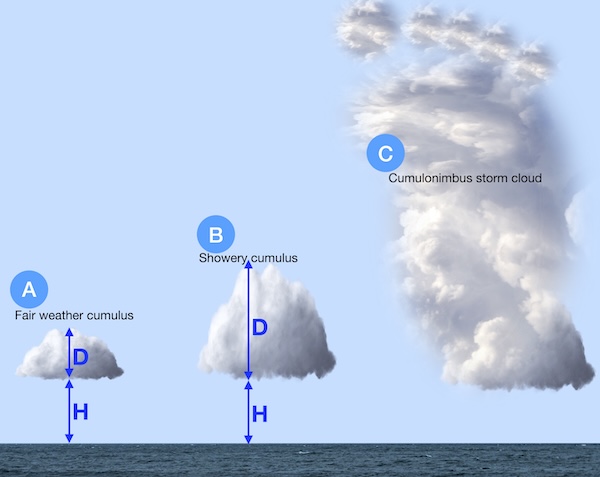
With these fair weather clouds (A in the diagram above), the depth of the cloud (D) is less than the height of the cloud (H).
If the process of warm, humid air rising and forming clouds continues, the cloud can eventually become deeper than its height off the ground (D>H), as shown as B in the diagram above. At this point, the cloud may return its moisture to the ground in a rain shower. It’s likely that this process will happen faster on hot, humid days.
When warm humid air rises unchecked into the atmosphere, the cumulus clouds can become very deep indeed - perhaps 10 km tall! These towering clouds with dark bases are known as ‘Cumulonimbus’, or more commonly ‘thunderclouds’ (C in diagram above). The thunderstorms that they create can produce thunder, lightning, hail and strong localized winds.
If you see fair weather cumulus in the morning, it’s worth keeping an eye on the sky to see if they develop into taller clouds carrying showers, or even cumulonimbus storm clouds, through the day.
