4.1 Practicalities*
4.1.1 On the water
The limited space available on a kayak deck means that we need to give some thought to how we organize ourselves to navigate on the water.
4.1.1.1 Waterproofing
Neither a map nor a chart is much use if it’s soaked in seawater and falling apart. It’s clear that you’ll need to do something to keep your map or chart dry if you’re going to use it at sea on the deck of a kayak. There’s more information in the ‘Practicalities’ section, but basically your options are to:
Place the map in a waterproof map case. Beware - most map cases are designed to withstand a bit of rain, not the complete immersion possible on a sea kayak deck! Many paddlers used to swear by the ‘Axel pack map case’, but this no longer seems to be available. I’ve got no specific recommendations (other than to test whatever you decide to use thoroughly), although Whetman Equipment, who usually make excellent kit, do offer one.
Buy waterproof maps and charts. OS maps are available laminated, but these are only described as ‘weatherproof’. Some Imray charts are available laminated.
Laminate them yourself. This is time consuming, but allows you to cut your maps and charts to the size you want, and make use of printouts where these are available.
Given that neither laminating or map cases can be relied on to be perfectly waterproof, I’d suggest using both methods - placing laminated maps in a waterproof map case. Another advantage of laminated maps is that you can make notes on them with OHP pens - these notes can later be removed with isopropyl alcohol, alcohol wipes or whisky.
4.1.1.2 Carrying maps and charts
Many kayakers place their map under their front deck elastics. I find that a map placed there is too far from me to read, so I prefer to keep my map closer. I uses a spray deck with elastics to which I’ve attached a map case.
4.1.1.3 Other equipment for the boat
It’s useful to carry some other navigation equipment in the boat:
A baseplate compass.
Chinagraph pencil (and possibly OHP pen) for making notes on maps, or even the kayak deck.
A GPS unit - although I rarely use mine, it’s a good backup in poor visibility and it allows position to be given very precisely in the even of needing outside assistance.
It’s useful to keep this equipment to hand - perhaps in a buoyancy aid pocket, or a small hatch in front of the cockpit.
4.1.1.4 My setup
There’s lots of options for how and where to carry navigation equipment when you’re out on the water. Here’s what I choose to do:
I carry laminated sections of map 26cm x 26cm in an Ortlieb map case. This holds the map securely in place and provides 2 waterproof barriers. Whilst the map case isn’t all that waterproof by kayaking standards, I can use a non-waterproof map on sunny days with flat water. It turns out that this size of map can be stored in boxes designed for vinyl records.
The map case eyelets are threaded onto the shock cord of my Peak Explorer spraydeck. A spraydeck mounted chart case keeps the map close enough to be easily readable – for boats like my Cetus that have a small hatch in front of the cockpit, it would otherwise be a long way forward. Also, the map is always with me when I’m out of the boat.
If there’s any substantive navigation to be done, I’ll carry a hiking compass in a buoyancy aid pocket, with the loop of cord attached to the waist strap on the buoyancy aid with a larks foot knot.
My boat has a steering compass - I use it to check my direction when following coastlines as well as when following bearings in open water.
The small hatch in front of me contains a chinagraph pencil, and OHP pen and a GPS unit. The GPS unit only comes out for crossings in fog or when I want a precise and certain grid reference - e.g. for the coastguard. The chinagraph pencil is good for scribbling notes on the boat - especially when listening to weather forecasts over VHF.
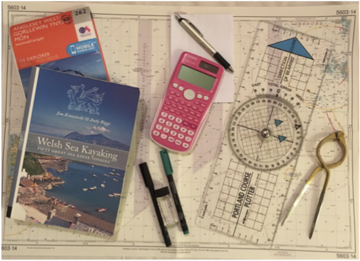
4.1.2 On dry land
In addition to the simple equipment carried in the boat, it is helpful to have some items with you on the trip for evening planning. These might include:
- Larger maps and, possibly, charts to give an overview of the area
- Sources of tidal information – tide times, pilots etc.
- Portland plotter (like a big hiking compass, only really necessary for advanced work)
- OHP pens for marking up laminated maps
- Isopropyl alcohol (or whisky!) to remove OHP pen annotations
- Pen, pencil and scrap paper for tidal calculations
- Calculator (if mental arithmetic is poor and you want to be precise)
- Smartphone – great for weather forecasts and tide times.