1.2 Air masses
Although a decent forecast is all that is really necessary to plan a day’s sea kayaking, some knowledge of the science behind the weather can help you understand what is going on and put the weather that you observe from your kayak into context.
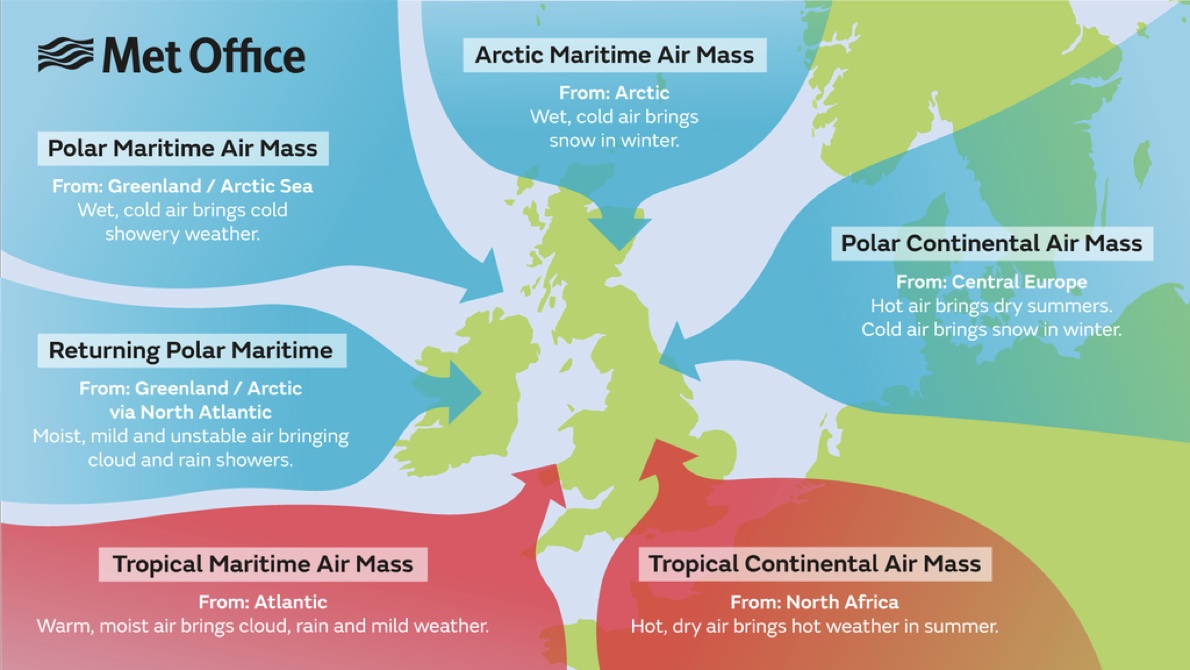
Let’s begin by thinking about how the earth’s surface affects the air above it. Air that spends time over cold land cools and becomes fairly dry. Over a warm sea, the air will be heated and become moist. Depending on the wind direction, air that has spent time over other parts of the world can blow over the UK. The diagram below shows these air masses and the wind directions that bring them to us:
Air masses move, but when they meet they tend not to mix well. Instead, there are sharp divisions between them known as fronts.
Warm air tends to rise. As air rises, it cools and any water vapour that it is carrying will form clouds and potentially rain. The condensation of water vapour makes more heat available, such that wet air tends to rise further and faster than dry air.
What might cause air to rise? The air masses shown above are fairly homogenous, so there will be little tendency for air to move vertically. There are two key processes that cause air to rise, forming clouds and potentially rain:
Being pushed up by another air mass at a front - more of this later
Being heated by the warm earth below, which in turn is being warmed by the sun. This is the process by which white puffy cumulus clouds develop on sunny days and how they can eventually develop into violent thunderstorms in the afternoon.