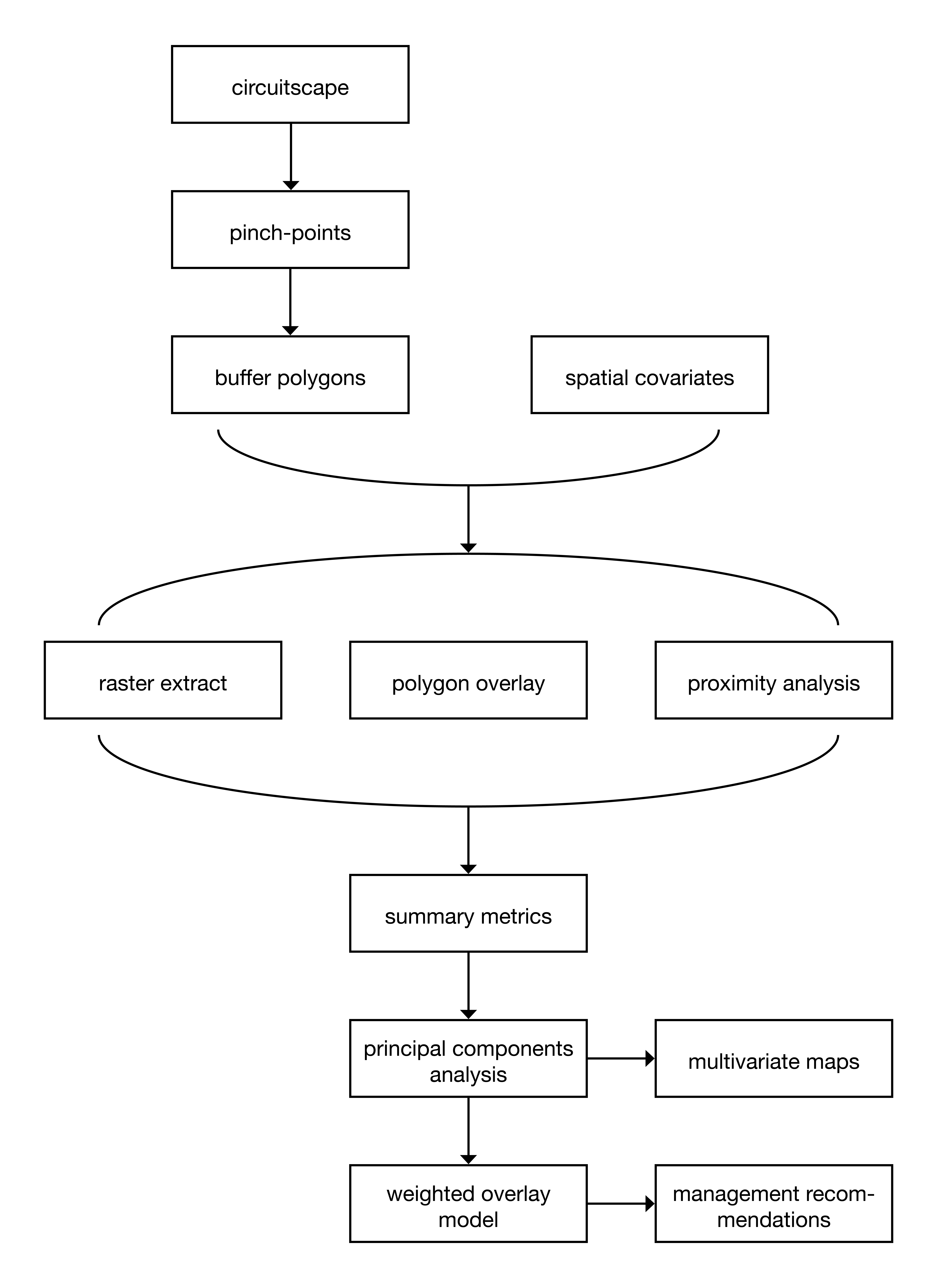
Workflow overview
Study design
The following details my methods workflow (1.1).

Figure 1.1: Conceptual model of project workflow
Methods outline
Identify relevant layers
identify constraints on connectivity (variables that may contribute to pinch points (roads, river, slope, etc.)
- base this on criteria used by solstice in developing their resistance map
group variable into classes
buildings
roads
natural barriers
human barriers
Prepare spatial covariates
clip layers to proper extent
add data to geodatabase
transform layers to a nonresistant CRS
reclassify/sort data within layers as needed
weight data according to ease of management
prepare circuitscape polygons,
obtain circuitscape polygons representing pinch-points
assign a numerical identifier to each pinch-point polygon
join small, clustered polygons together as single features
create a buffer around each pinch-point polygon
Summarize land cover data within pinch-point polygons
Methods of summarizing variables will vary according to variable type
raster extract
polygon overlay
proximity analysis
calculate metrics for each polygon including:
mean values
slope
brightness (light pollution)
human activity
proportion of polygon represented by a value
vegetation (species, type)
urban infrastructure
buildings
parking lots
distance of feature to pinch-point
proximity to barriers
roads
gates
river
trails
count of features within polygon
- trails
Identify areas best suited for management
- additive weighted overlay model
Visualize polygon characteristics
- multivariate maps