5.3 Coastal Navigation
The simplest approach to coastal navigation is simply to follow a linear feature (like a coastline) and know how far along this we are by the things that we have passed.
What landmarks would we expect to see on a paddle from Portloo to Old Town?
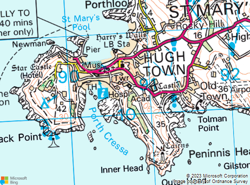
Paddling out of Portloo, turn left around a rocky area (island at HW). Pass a small beach, a rocky promontory, a second beach and a lifeboat station. Paddle past the town beach and round the pier. Pass a small island, turning left. Pass a point and turn left again. Left again at a point with a beacon offshore. Sharp left inside some islands into a beach with buildings behind. Back out of this bay, past an indent (island) to a major headland (lighthouse). Round the headland, offshore island, smaller headland and into Old town bay (look for main road and the town).
The Ordnance Survey, who create maps for the UK, have lots of resources on map reading that you might find useful.