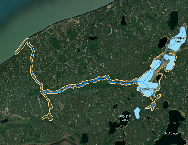
4 Watershed Mapping
Watershed mapping efforts for this project include a combination of on the ground fieldwork and GIS based approaches.
An ArcGIS Online interactive map outlining fieldwork sites and associated results is found at the following link: https://arcg.is/199PPj
Technicians walked the Miller Creek corridor on foot on May 27-28, 2021 to identify hydrologic features that may be difficult to identify from the air, such as seepages and springs. The locations are visible in the ArcGIS Online map in the “Hydrologic Connectivity” layer, and may be downloaded here as .gpx files:
All hydrologic features (n = 67): miller_creek_features.gpx
Only seepage hydrologic features (n = 16): miller_creek_seepage_features.gpx
The seepage/spring hydrologic features were important to locate because of their potential to serve as refugia for invasive pike during the eradication process. These locations required special attention in order to ensure that rotenone permeated the watershed. However, the fieldwork of finding these locations was labor-intensive and prone to miss features that the human eye does not recognize
Future researchers tasked with identifying and locating such features may wish to consider using thermal infrared imagery (TIR). The technique has been successfully applied to identify thermal refugia for salmon in several Kenai Peninsula watersheds and helped develop empirically based land conservation priorities. The technique requires additional technical knowledge of remote sensing and GIS processing, but for large, remote projects where knowledge of such features is critical the technology may offer a much more robust methodology. See https://inletkeeper.org/our-work/healthy-habitat/cold-water-refugia/ for more information.
