library(geodata)
library(raster)
library(plotly)
library(sf)
library(dplyr)

# Step 1: Define a Larger Bounding Box for Paris Region
paris_bbox <- st_bbox(c(xmin = 2.0, ymin = 48.6, xmax = 2.6, ymax = 49.2), crs = 4326)

# Step 2: Download SRTM Elevation Data for France
# Save in a temporary directory (can be set to a permanent path)
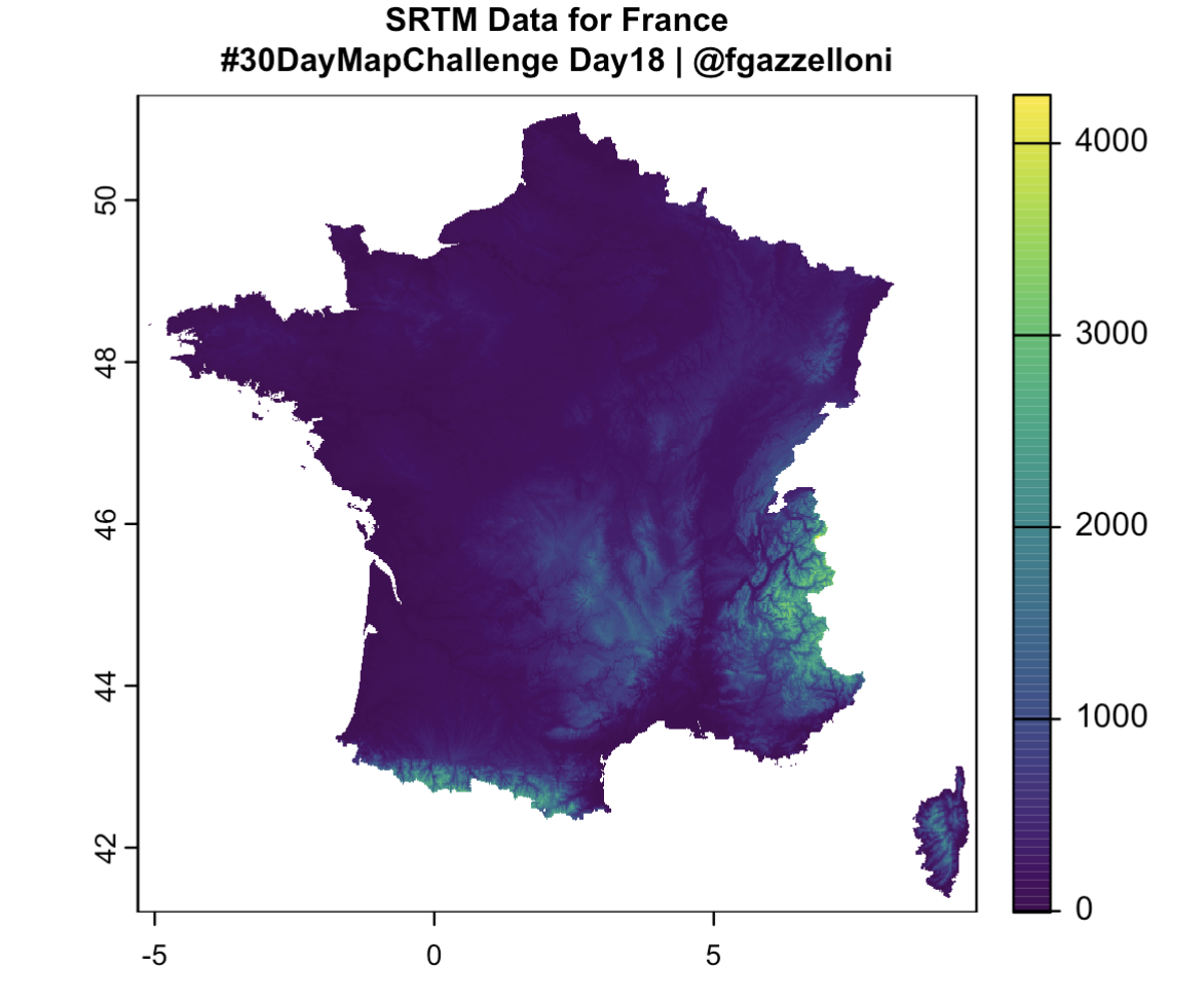
srtm_data <- elevation_30s(country = "FRA", path = tempdir())

# Verify if the SRTM raster contains valid data
print(srtm_data)  # Print details of the raster
plot(srtm_data, main = "SRTM Data for France\n#30DayMapChallenge Day18 | @fgazzelloni",cex.main = 0.8)  # Check if it contains data
# Set the file path and PNG dimensions
png(filename = "srtm_data_france_day18.png", width = 800, height = 600, res = 150)

# Plot the SRTM raster data with customized title
plot(
  srtm_data,dpi=300,
  main = "SRTM Data for France\n#30DayMapChallenge Day18 | @fgazzelloni",
  cex.main = 0.8,     # Main title size
  col.main = "grey20",  # Main title color
)

# Close the PNG device
dev.off()
# Step 3: Crop the SRTM Data to Paris Bounding Box
paris_bbox_sp <- as(extent(paris_bbox$xmin, paris_bbox$xmax, paris_bbox$ymin, paris_bbox$ymax), "SpatialPolygons")
crs(paris_bbox_sp) <- crs(srtm_data) # Match CRS with the raster
elevation_data <- crop(srtm_data, paris_bbox_sp)
# Verify the cropped raster for Paris
print(elevation_data) # Check for valid data
plot(elevation_data, main = "Cropped Elevation Data for Paris")
# Step 4: Convert Raster to Data Frame
if (!is.null(elevation_data)) {
elevation_matrix <- raster::as.matrix(elevation_data)
elevation_df <- as.data.frame(as.table(elevation_matrix)) %>%
rename(row = Var1, col = Var2, elevation = Freq) %>%
mutate(
row = as.numeric(row),
col = as.numeric(col),
lon = raster::xFromCol(elevation_data, col),
lat = raster::yFromRow(elevation_data, row)
) %>%
drop_na() # Remove rows with missing data
# Step 5: Verify the Data Frame
print(summary(elevation_df)) # Check for valid values
print(head(elevation_df)) # Inspect a few rows
} else {
stop("Elevation data is empty after cropping!")
}
#